Yesterday I was kind of spooked by the lack of tent sites in the area. I set my sights on getting to Curly’s Corner Bar, which apparently let cyclists camp in the yard. This bar was about 65 miles away, which is getting to be my target mileage these days.
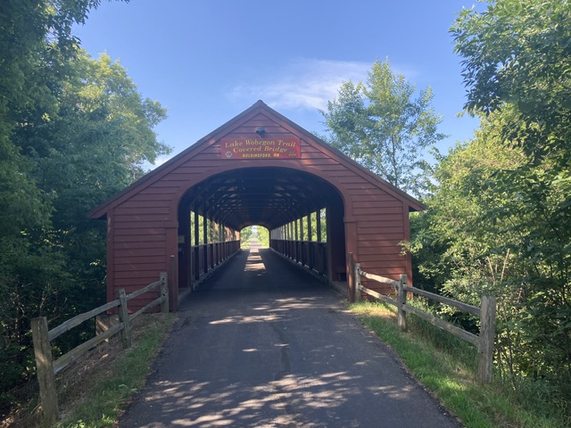
The first part of the ride, was a repeat of yesterday’s rail trail experience. This cute covered bridge was recently built just for users of this rail trail network.
In total, between yesterday and today, I covered about 95 miles on rail-trails before jumping onto some rural roads. Soon after leaving the rail trail network, I came to a detour sign, local traffic only, road closed in one mile. Dilemma, try sneaking through and risk having to backtrack or just take the detour. Consulting with Google Maps made me think that there was bridge work going on, which I couldn’t sneak around. I decided to take the detour.
After a mile or so on the detour route, I saw a road going the right direction. Consulting with Google maps made me think it went through and would reconnect with the highway I needed to be on.
No sooner had I started down this road when I heard the unmistakable sound of paws in a hurry on pavement and it wasn’t far away. I turned and saw a pit bull looking creature in hot pursuit of me. I didn’t speed up, but yelled at him and reached for a water bottle. A squirt in the nose might stop him if the cursing didn’t. Fortunately the curse worked and he turned back. This is only the second time on this trip that a dog came after me.
Next my unofficial detour route turned to dirt/gravel which is probably why it wasn’t the official detour route. After a number of miles I reached a crossroad that was paved and according to Google would bring me back to my route past the construction.
About a quarter of a mile down this road, another loose dog started after me. This one looked like a hunting breed. He stopped, like the first one, when I yelled at him, so the water bottle experiment wasn’t needed.
Back on the route, I stopped for a breather and decided to check the map update system, which is a ABA online message system that gives up to date info that may not be included in the latest maps. Good thing I did because it noted that Curly’s was closed.
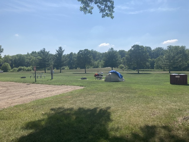
Next available stopping point was the town of Milaca, another 13 miles on, which has camping in the city park. I called the number to see what the situation was. Turns out they only had 4 sites, one of which was reserved. Despite the hot weather and 65 or so miles I already had done, I put on the afterburners to see if I would end up with one of the remaining sites. It turns out my rush was unnecessary, since all three remaining sites were available when I arrived.
No shade here, but at least I have a safe place to sleep.
79 miles today for a total of 1968 miles covered. Google says I’m only 75 miles away from Osceola, WI.